Finding nearby trailheads with access to easy and scenic hiking trails is the holy grail for the armchair adventurer, the weekend warrior, and even the seasoned hiker looking for a less-strenuous, yet still breathtaking, escape. This quest, however, isn’t just about stumbling into the woods; it’s about strategic planning, savvy resource utilization, and a healthy dose of digital detective work.
We’ll equip you with the tools and knowledge to navigate the wilderness of online trail data, decipher the cryptic language of “easy” and “scenic,” and ultimately, discover your next perfect hiking adventure. Prepare for a journey that’s more rewarding than a perfectly packed trail mix!
From identifying reliable online resources to mastering the art of interpreting trail difficulty ratings and conditions, this guide is your passport to a world of breathtaking trails. We’ll delve into the nuances of geographic information systems (GIS), equipping you to utilize mapping software effectively. Learn how to assess trail accessibility, ensuring your hike is both enjoyable and safe. Finally, we’ll cover essential planning elements for a successful and environmentally conscious trip.
Get ready to lace up those boots!
Identifying Reliable Data Sources for Trail Information

So, you’re itching to hit the trail, but navigating the wilderness of online trail information can feel like, well, navigating the wilderness itself. Fear not, intrepid hiker! Finding accurate and up-to-date trail data is crucial for a safe and enjoyable adventure. This section will illuminate the path to reliable resources, helping you choose the perfect trail without ending up hopelessly lost (or worse, face-to-face with a grumpy bear who’s had a bad berry harvest).
Reputable Online Resources for Trail Information
Choosing the right online resource is the first step in your hiking planning. Different websites offer varying levels of detail and features, catering to different hiking styles and experience levels. Here are five reputable options to consider:
- AllTrails: A behemoth in the trail world, AllTrails boasts a massive database of user-submitted trails, complete with photos, reviews, and difficulty ratings. Its user-friendly interface makes finding trails a breeze.
- Hiking Project: Similar to AllTrails, Hiking Project provides detailed trail information, including elevation profiles, maps, and user reviews. It often integrates with other mapping services for a more comprehensive view.
- Trailforks: A great option for mountain bikers, but also useful for hikers, Trailforks excels in providing detailed trail maps, including technical trail features. Its focus on the technical aspects of trails makes it particularly valuable for experienced hikers.
- Gaia GPS: A powerful GPS app with offline mapping capabilities, Gaia GPS is perfect for serious hikers who need reliable navigation even without cell service. Its robust mapping features and integration with other data sources make it a top choice for backcountry exploration.
- Local Parks and Recreation Websites: Often overlooked, local government websites are invaluable for finding information on trails within a specific area. These websites usually provide accurate, up-to-date information on trail conditions, closures, and permits.
Comparing and Contrasting Features and Usability
Each of these platforms offers a unique set of features, making the choice of which to use dependent on your individual needs. AllTrails and Hiking Project are excellent for beginners due to their ease of use and comprehensive trail descriptions. Trailforks caters more to experienced hikers and mountain bikers due to its technical details, while Gaia GPS is a premium option for those needing advanced navigation features.
Enhance your insight with the methods and methods of top-rated short hikes near me with minimal elevation gain.
Local park websites provide hyperlocal trail details but lack the breadth of national trail information.
Criteria for Evaluating the Accuracy and Reliability of Trail Information, Finding nearby trailheads with access to easy and scenic hiking trails
Navigating the online trail world requires a discerning eye. To ensure you’re using accurate information, consider these factors:
- Recent Updates: Check the last updated date of trail information. Outdated information can lead to unpleasant surprises on the trail.
- Multiple Data Points: Don’t rely on a single source. Cross-reference information from several reputable websites to confirm trail conditions and difficulty.
- User Reviews: Pay attention to user reviews. Look for patterns in feedback regarding trail conditions, difficulty, and safety.
- Photo Verification: Photos submitted by users can help verify trail conditions and features. Be wary of outdated or misleading photos.
- Official Sources: Always prioritize information from official sources like park websites or land management agencies.
Comparison of Data Source Features
The following table summarizes the key features of the five resources mentioned above:
| Feature | AllTrails | Hiking Project | Trailforks | Gaia GPS | Local Parks & Rec |
|---|---|---|---|---|---|
| Map Quality | Excellent | Excellent | Excellent (esp. MTB) | Excellent (offline capability) | Good (varies greatly) |
| Trail Difficulty Ratings | Yes, user-submitted | Yes, user-submitted | Yes, detailed technical ratings | Yes, customizable | Sometimes |
| User Reviews | Yes, abundant | Yes, abundant | Yes, focused on technical aspects | Limited | Sometimes |
| Offline Maps | No (premium features) | No | No | Yes | No |
Defining “Easy” and “Scenic” Hiking Trails
So, you want to find an easy, scenic trail? Sounds idyllic, right? Like a postcard come to life, minus the annoyingly perfect family posing in the foreground. But defining “easy” and “scenic” can be trickier than wrangling a herd of particularly stubborn goats. Let’s unravel this Gordian knot of hiking terminology.Defining what constitutes an “easy” trail involves a delightful trifecta of factors: elevation gain, trail length, and terrain.
Think of it as a Goldilocks problem – you want a trail that’s not too challenging, not too boring, but just right.
Easy Trail Characteristics
An “easy” hiking trail generally features minimal elevation gain, ideally under 500 feet (150 meters) of total ascent. This means less huffing and puffing, and more time to enjoy the scenery (or your meticulously curated hiking playlist). Trail length should be relatively short, typically under 5 miles (8 kilometers). Longer trails might be considered easy if the elevation gain and terrain are minimal.
Finally, the terrain should be relatively smooth and even, with few obstacles like significant rock scrambling or steep inclines. Think well-maintained paths, possibly even paved sections in some cases. Imagine strolling through a park rather than scaling a cliff face. A trail with lots of switchbacks, even if short, might not be considered “easy” due to the cumulative effort involved.
Find out about how good hiking trails near me for bird watching can deliver the best answers for your issues.
Scenic Trail Features
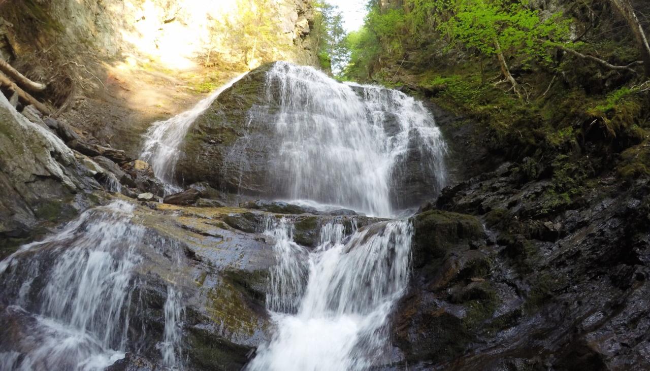
Now, for the “scenic” part – this is where things get a little more subjective. While “easy” is fairly quantifiable, “scenic” is entirely in the eye of the beholder. However, some common features contribute significantly to a trail’s scenic appeal. Think breathtaking viewpoints offering panoramic vistas, perhaps with a majestic mountain range as a backdrop. Natural landmarks like waterfalls, unique rock formations, or ancient trees add to the charm.
Biodiversity plays a significant role; a trail teeming with vibrant wildflowers, interesting birds, or playful squirrels instantly elevates the experience.
Subjectivity and User Reviews
The truth is, “easy” and “scenic” are relative terms. What one person considers a leisurely stroll, another might find strenuous. Similarly, a trail brimming with wildflowers might leave a botanist ecstatic, while a person allergic to pollen might find it less appealing. User reviews on hiking apps and websites can provide valuable insights into others’ experiences, offering a glimpse into the subjective nature of these descriptors.
However, remember that individual preferences and fitness levels significantly impact these perceptions.
Criteria for Determining Scenic Value
Before embarking on your next adventure, consider these criteria for evaluating a trail’s scenic potential:
- Viewpoints and Panoramic Views: The presence and quality of viewpoints offering expansive vistas.
- Natural Landmarks: Unique geological formations, waterfalls, caves, or unusual trees.
- Biodiversity: The variety and abundance of flora and fauna along the trail.
- Water Features: Streams, rivers, lakes, or even ponds add visual interest and tranquility.
- Seasonal Variations: How the trail’s appearance changes throughout the year (e.g., fall foliage, spring wildflowers).
- Overall Atmosphere: The feeling or mood evoked by the trail’s environment (e.g., peaceful, exciting, mysterious).
Locating Nearby Trailheads Using Geographic Information: Finding Nearby Trailheads With Access To Easy And Scenic Hiking Trails
So, you’ve decided to ditch the couch and embrace the great outdoors. Excellent choice! But before you’re knee-deep in scenic vistas, you need to find those trailheads. This is where the magic of geographic information systems (GIS) and your trusty smartphone come in – no more relying on questionable directions from a dusty map found at the back of a gas station.Using GPS coordinates and mapping software is like having a personal trailhead scout, always ready to point you towards your next adventure.
These tools allow you to pinpoint your location and search for nearby trails based on various criteria, such as distance, difficulty, and even the presence of particularly photogenic waterfalls (because, let’s be honest, that’s a crucial factor).
Using Mapping Applications to Locate Trails
Mapping applications offer a treasure trove of information, allowing you to filter your search based on proximity and trail difficulty. Imagine this: you’re in a new city, yearning for a gentle stroll with a view. You open your app, set your location, specify a distance radius (say, 10 miles), and filter for “easy” trails. The app will then display a map with potential trailheads marked, complete with distance, elevation gain, and often, user reviews (because who doesn’t love a good trail review?).
Challenges in Using Geographic Information for Trailhead Location
While incredibly helpful, geographic information isn’t always perfect. Outdated data is a common culprit. A trail might be closed for maintenance, rerouted, or even completely vanished, yet the app still shows it as accessible. Similarly, inaccurate mapping can lead you astray, especially in areas with less detailed mapping. You might find yourself bushwhacking through a thicket instead of enjoying a leisurely hike, a scenario best avoided unless you’re training for a survival show.
Therefore, always cross-reference information with other sources, such as local hiking websites or guidebooks, before venturing out.
A Step-by-Step Guide to Finding Nearby Trails
Let’s say you’re using a popular mapping app. Here’s a typical workflow:
1. Locate Yourself
The app will automatically pinpoint your location using GPS. You’ll see a small blue dot on the map representing your current position. The map display would typically show a street map view, possibly with satellite imagery overlaid.
2. Search for Trails
Most apps have a search bar. Type “hiking trails” or “trailheads” and hit enter. The map will populate with trail markers, potentially color-coded by difficulty.
3. Set Filters
Refine your search using filters. Specify a maximum distance from your location, choose a difficulty level (easy, moderate, hard), and perhaps even filter by trail length or type (loop, out-and-back). This filtering process is usually done through a sidebar menu or dropdown options. A hypothetical screenshot would show checkboxes for ‘Easy’, ‘Moderate’, ‘Hard’, with sliders for distance and length.
4. Select a Trail
Once you’ve narrowed down your options, tap on a trail marker. The app will display detailed information, such as trail length, elevation gain, estimated hiking time, and often user reviews and photos. A sample information panel might show a trail name, a star rating, a distance indicator, and a small preview image, all neatly organized.
5. Navigate to the Trailhead
The app will provide directions to the trailhead, often with options for driving, walking, or cycling. The navigation section might show a turn-by-turn map with directions, potentially even providing voice guidance.Remember, always check the trail conditions before you go and let someone know your hiking plans. Happy trails!
Assessing Trail Conditions and Accessibility

So, you’ve found your potential hiking haven – a list of nearby trailheads promising easy, scenic strolls. But before you lace up those boots and unleash your inner mountain goat (or, let’s be honest, your inner slightly-out-of-breath-but-determined hiker), it’s crucial to check the trail’s current vibe. Ignoring this step is like showing up to a picnic without checking if someone already ate all the sandwiches – disappointing, and possibly leading to hangry hikers.Assessing trail conditions isn’t just about avoiding a muddy mishap; it’s about ensuring a safe and enjoyable experience.
We’re talking about avoiding unexpected detours due to closures, navigating tricky terrain, and preventing that “I wish I’d known that before I started” moment. Let’s dive into how to get the lowdown on your chosen path before you embark on your adventure.
Trail Condition Reporting Methods
Several avenues exist for determining the current state of a trail. Think of it like a detective investigation, but instead of solving a crime, you’re solving the mystery of whether the trail is currently passable and enjoyable. Recent user reviews on platforms like AllTrails or Hiking Project provide a wealth of real-time information, offering firsthand accounts of trail conditions.
These reviews often include details on muddiness, trail obstacles, and overall difficulty. Remember to check the date of the review to ensure its relevance. Additionally, contacting local park authorities or ranger stations directly can yield valuable insights, especially concerning recent trail closures or maintenance work. They’re the trail’s official guardians, and they know what’s up (or down, if there’s a landslide!).
Factors Affecting Trail Accessibility
Numerous factors can influence a trail’s accessibility, some predictable and others… well, less so. Weather conditions, particularly rainfall or snow, can dramatically alter trail conditions. Imagine a lovely, well-maintained trail transforming into a muddy obstacle course after a downpour. Trail closures, often due to maintenance, repairs, or natural events, are another significant factor.
These closures can be temporary or long-term, so checking for official announcements is vital. Potential hazards, such as fallen trees, wildlife encounters (hopefully not the aggressive kind!), or steep, exposed sections, can also affect accessibility. Understanding these potential obstacles helps you prepare adequately for your hike.
Real-Time Trail Condition Updates
Several resources offer real-time or near real-time updates on trail conditions. AllTrails and Hiking Project are great starting points. These platforms allow users to post photos and comments about their recent experiences, providing up-to-the-minute information. Many national and state park websites also provide trail condition reports, often updated regularly. Local news sources or social media groups dedicated to hiking in your area can be invaluable sources of information.
Imagine a group chat buzzing with hikers sharing real-time trail updates – a community-driven early warning system for muddy trails!
Interpreting Trail Descriptions and Difficulty Ratings
Trail descriptions and difficulty ratings are your trusty compass for navigating the world of hiking. These descriptions often include details on elevation gain, trail surface (e.g., rocky, smooth), and water crossings. Difficulty ratings, typically ranging from easy to strenuous, provide a general indication of the trail’s challenge. However, these ratings are subjective and depend on the hiker’s fitness level and experience.
A “moderate” trail for a seasoned hiker might be a “strenuous” trail for a beginner. Always read descriptions carefully and consider your own abilities before embarking on a hike. Don’t underestimate the power of a well-written trail description! It’s your adventure’s pre-game playbook.
Planning a Safe and Enjoyable Hiking Trip
So, you’ve found your perfect trail – congratulations! Now, let’s make sure your adventure is as fun and safe as the stunning views promise to be. Proper planning is key to transforming a potential mishap into a memory you’ll cherish (in a good way, of course!).
A little preparation goes a long way in ensuring a safe and enjoyable hike. Remember, even the easiest trails can present unexpected challenges, and being prepared can be the difference between a fantastic day and a less-than-ideal one. Let’s get you equipped for success!
Essential Hiking Gear Checklist
Packing the right gear is crucial for a safe and comfortable hike. Think of it as your personal survival kit, but instead of battling zombies, you’re facing the elements and the occasional rogue squirrel. This checklist will help you avoid any unexpected surprises (except maybe the breathtaking scenery).
- Navigation: Map, compass, GPS device (or a smartphone with offline maps – because cell service isn’t always a given in the wilderness!). Knowing where you are is the first step to getting back safely.
- Sun protection: Sunscreen (at least SPF 30), sunglasses, and a hat. The sun’s rays are surprisingly strong, even on cloudy days.
- Insulation: Layers of clothing appropriate for the weather conditions. Even on a warm day, temperatures can drop significantly at higher elevations or in shaded areas.
- Illumination: Headlamp or flashlight with extra batteries. You never know when you might be caught out after dark (or if you just want to admire the stars).
- First-aid supplies: A comprehensive kit including bandages, antiseptic wipes, pain relievers, blister treatment, and any personal medications.
- Fire starter: Waterproof matches or a lighter. While hopefully not needed, it’s a good idea to have a backup plan in case of emergencies.
- Repair kit and tools: Knife or multi-tool for repairs to gear, and duct tape for anything that needs patching.
- Nutrition: Plenty of water and high-energy snacks. Think trail mix, energy bars, and fruit – enough to keep you going.
- Emergency shelter: A lightweight emergency blanket or bivy sack. Better to have it and not need it, than need it and not have it.
Minimizing Environmental Impact
Let’s leave the trail better than we found it! Respecting the environment is not just a good idea, it’s essential for preserving these beautiful places for future generations. Think of yourself as a nature ninja – stealthy and leaving no trace.
- Pack it in, pack it out: Carry out everything you carry in, including trash. Leave no trace behind.
- Stay on marked trails: Avoid damaging vegetation by sticking to designated paths.
- Respect wildlife: Observe animals from a distance and never feed them. Remember, they’re wild animals, not your furry friends.
- Minimize campfire impacts: If campfires are allowed, use existing fire rings and keep fires small. Always extinguish them completely before leaving.
Informing Others of Hiking Plans
Always let someone know where you’re going, who you’re with, and when you expect to be back. This simple step could be a lifesaver in case of an emergency. Think of it as your personal “hiking buddy” check-in – they can raise the alarm if you don’t return on time.
Provide specific details like the trail name, your planned route, and your estimated return time. Sharing your hiking plans with a friend or family member allows them to notify authorities if you don’t check in as expected.
Enhancing Hiking Enjoyment
Beyond safety, let’s make this a truly memorable experience! Embrace the beauty around you and make the most of your time on the trail. Remember, it’s not just about reaching the destination; it’s about the journey.
- Photography: Capture the stunning views and share them with your friends and family (but remember to be mindful of wildlife and avoid disturbing their natural habitat).
- Wildlife observation: Keep an eye out for birds, animals, and insects. Observe them from a distance and appreciate their natural beauty.
- Mindfulness and appreciation: Take time to breathe in the fresh air, listen to the sounds of nature, and simply appreciate the beauty of your surroundings.
- Enjoy the journey: Don’t rush. Take breaks to rest, hydrate, and soak in the views. The goal isn’t just to reach the end; it’s to savor every moment.
Outcome Summary
So, there you have it – a comprehensive guide to unlocking the secrets of nearby, easily accessible, and visually stunning hiking trails. Remember, the most scenic trails aren’t always the most challenging, and the most memorable hikes often involve a bit of planning and preparation. With the right tools and information, you can transform a simple weekend into an unforgettable adventure.
Now get out there, explore, and don’t forget your camera (and maybe some extra snacks)! Happy hiking!